Thousands Without Power as another Systems Brews

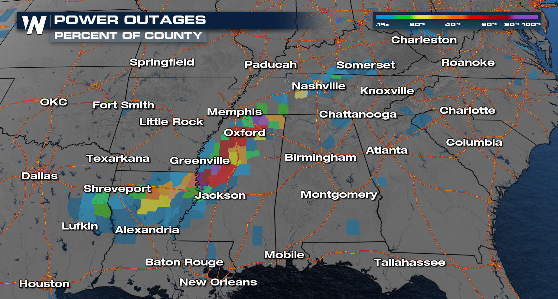
ABOVE - Up to one inch of ice accumulated across parts of Mississippi, Tennessee, and Louisiana, weighing down power lines and transmission equipment and causing widespread outages. As of Tuesday afternoon, roughly 300,000 customers remain without power. The threat continues with dangerously cold overnight lows expected throughout the week - and these predictions were accurate as nearly 300,000 people were still without power Thursday AM.
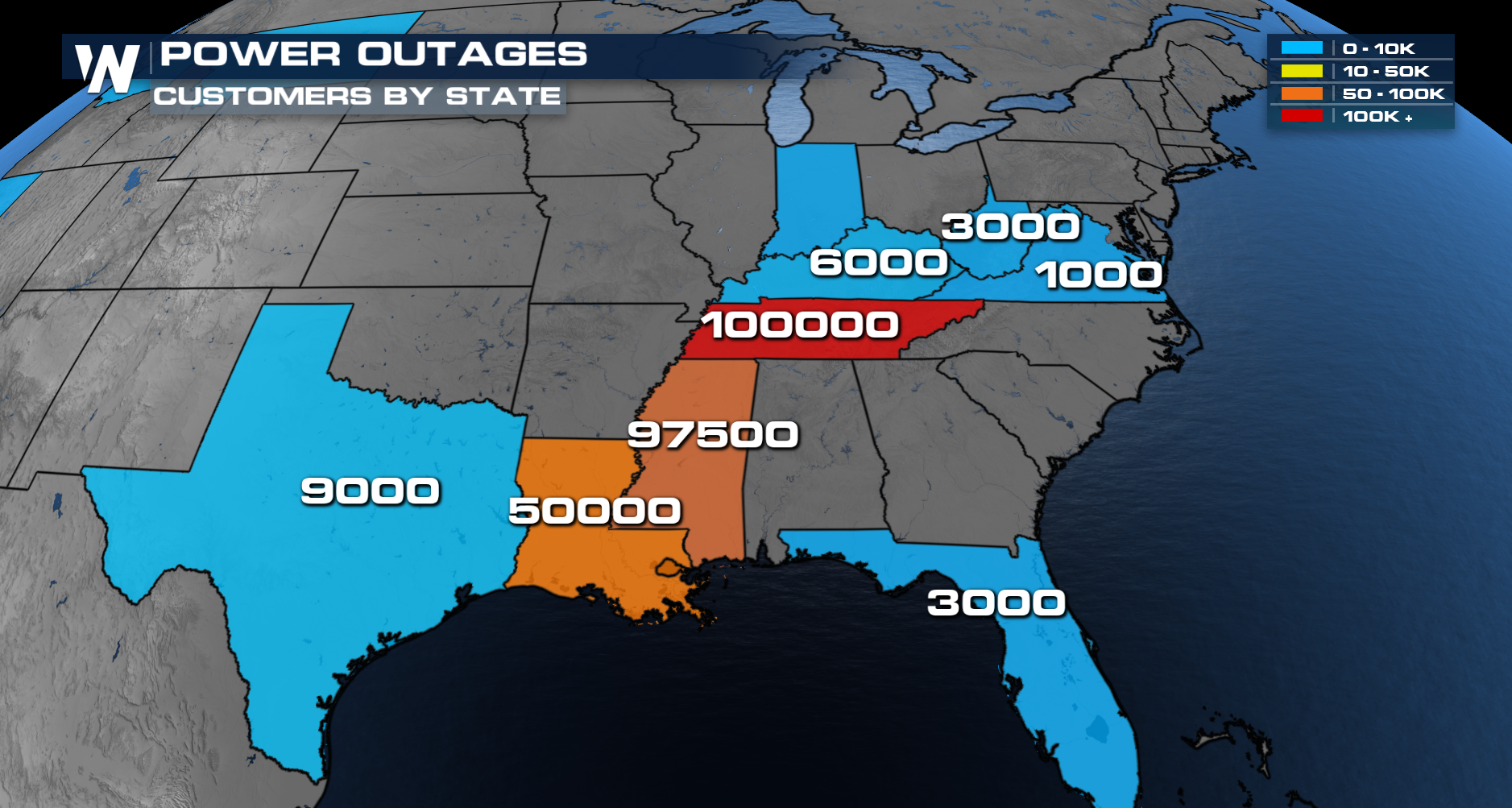
The impacts of this storm are expected to linger throughout the rest of the week. With power still out, many are still in danger as cold temperatures pose a serious risk. Lows are expected to remain well below freezing each night, increasing concerns for hypothermia, frozen pipes, and additional infrastructure damage.
Wintry Precipitation Totals
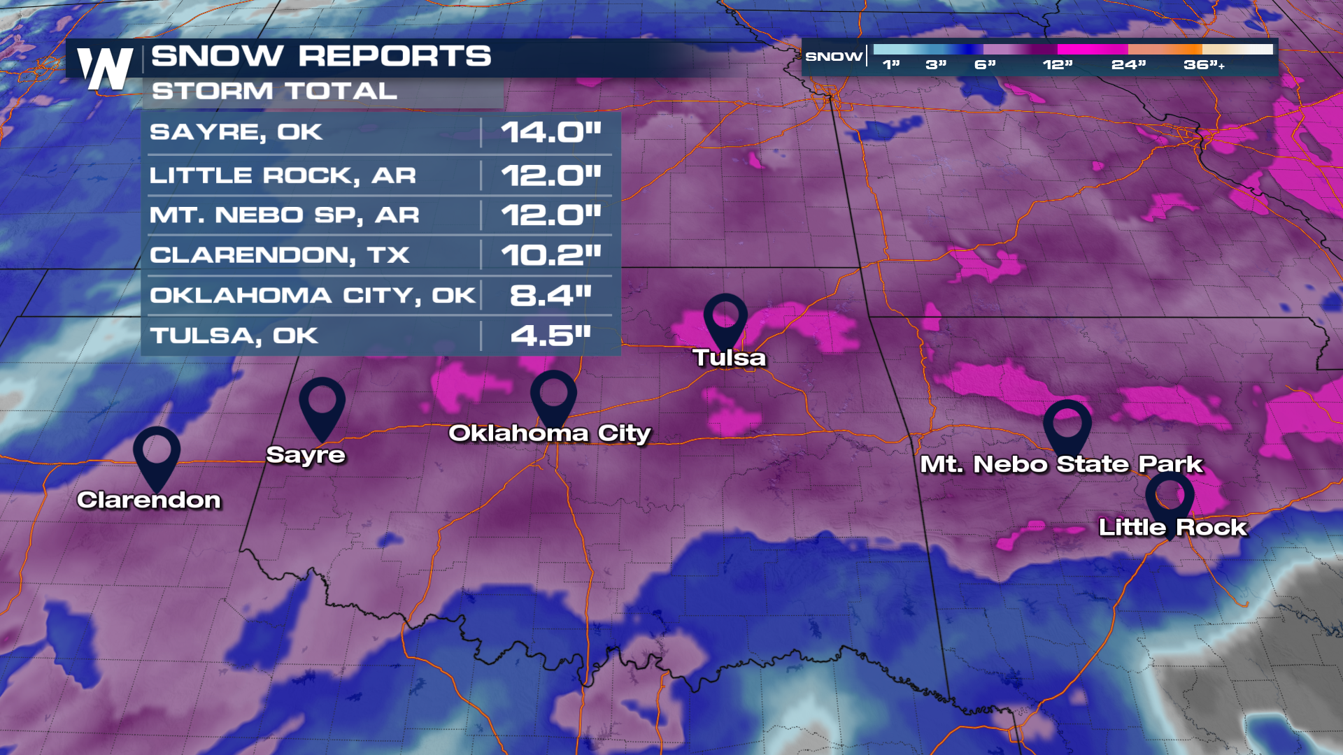
Snow started Friday in the South before switching over to sleet and ice on Saturday with our first round of precipitation. Our top snowfall totals maxed out around a foot for cities such as Little Rock, Arkansas.
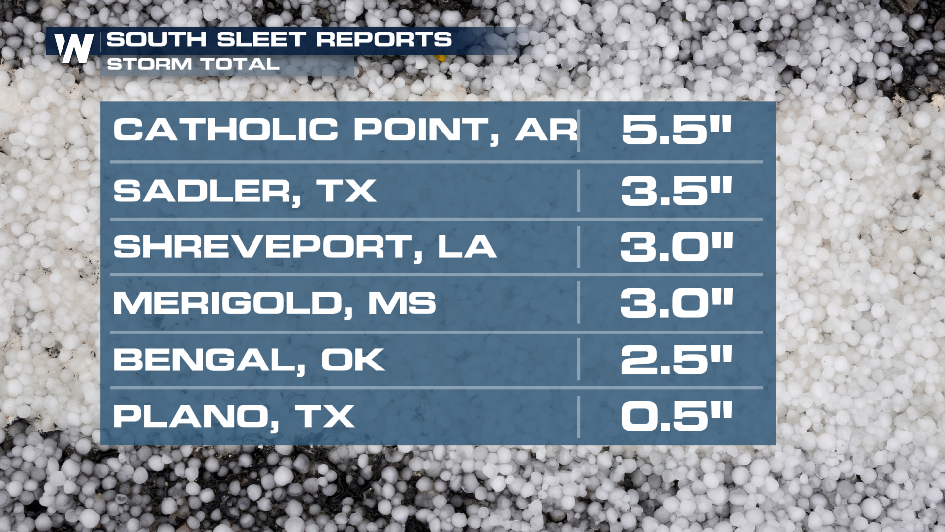
 Sleet altered the forecast a bit for some, with up to 5 inches reported in cities such as Catholic Point, Arkansas.
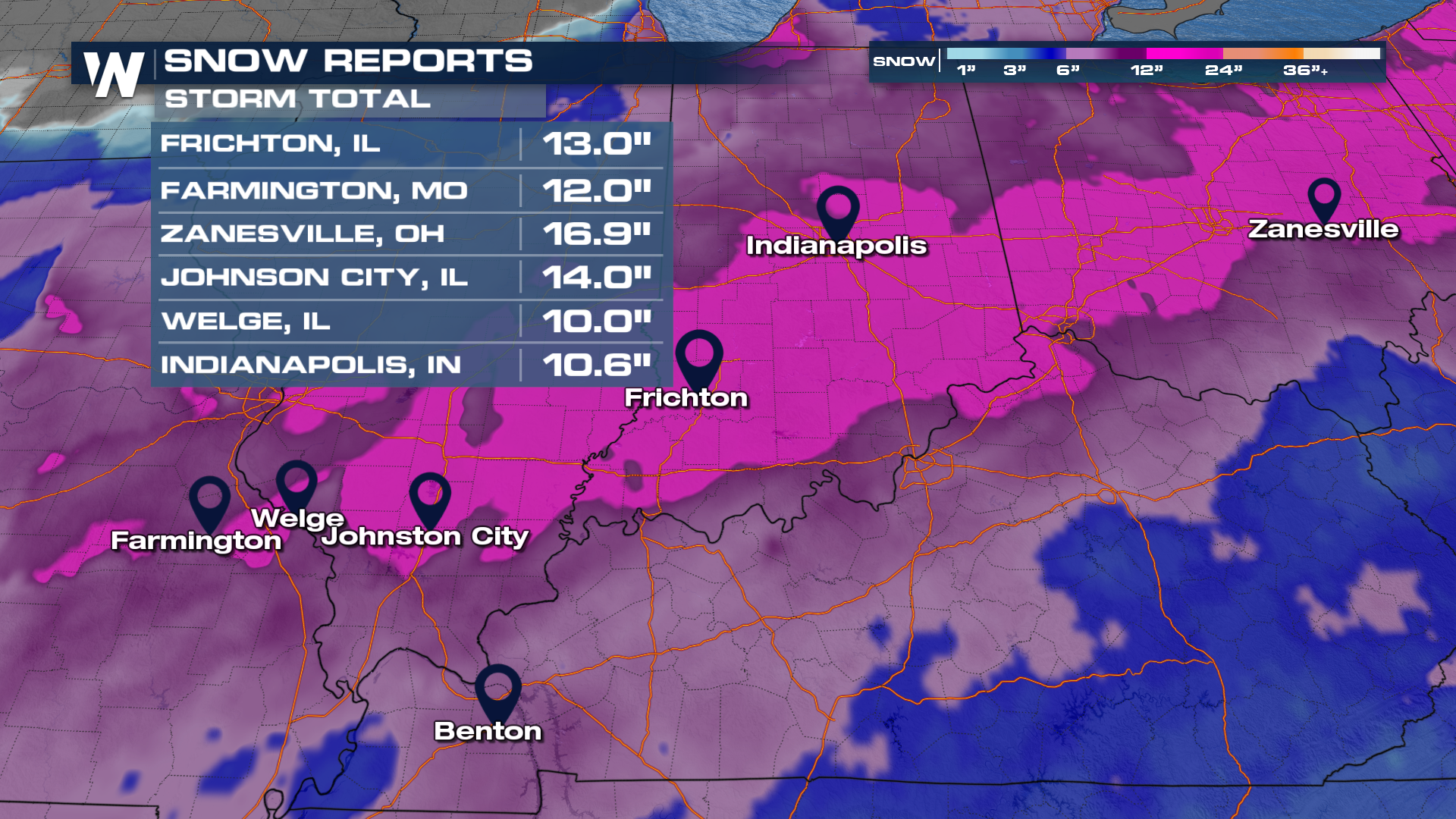
 In the Midwest, cities like Indianapolis, Indiana, received over 10 inches of snowfall from this storm.
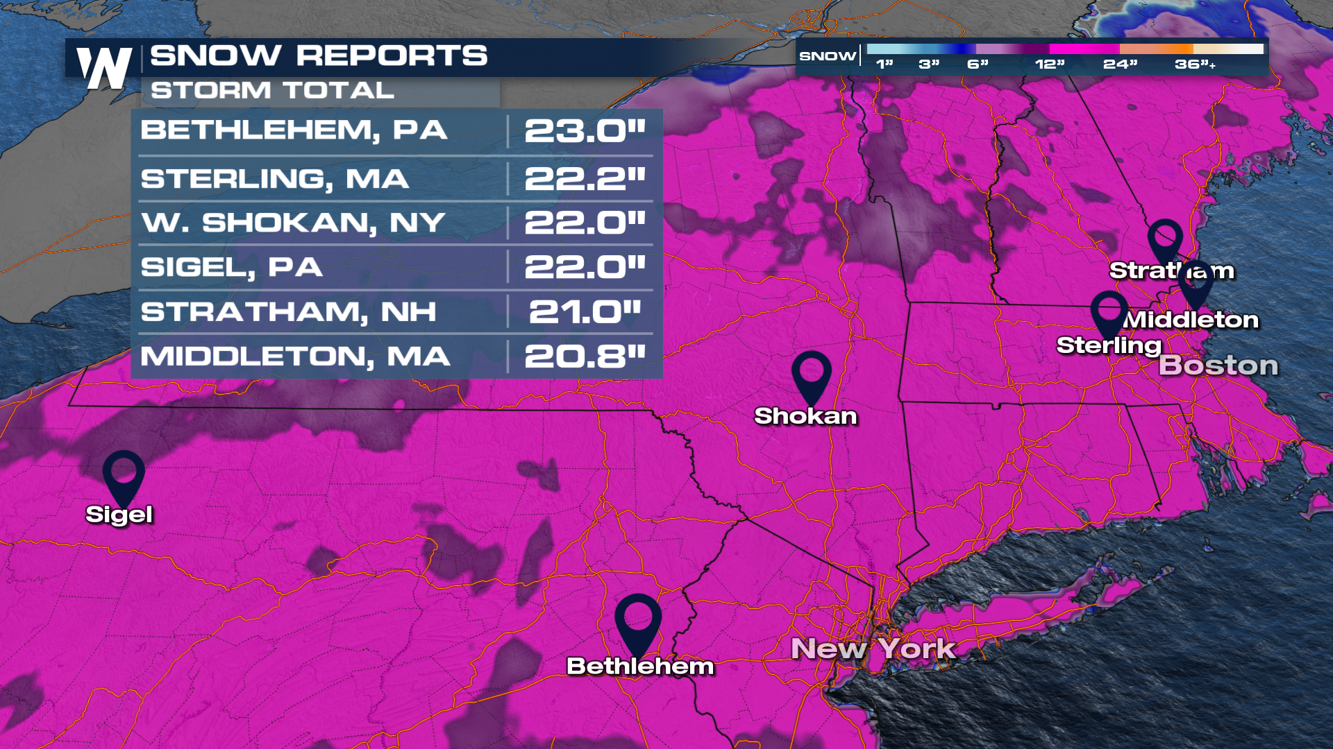
 In the northeast, this was a snow-only event. Cities near Boston received almost 2 feet of snowfall, resulting in a city-wide snow day on Monday!
 Headlines
Icing in Tennessee caused portions of the interstate (65) to be shut down after a truck lost control, hit a sign, and caused it to collapse.
Several fatalities have been confirmed from this winter storm, including a teenage girl in Frisco, Texas, being pulled by a sled by a Jeep on Sunday morning.
The city of Boston had a snow day after the mayor closed schools on Sunday for Monday.
For more details on power outages and the forecast ahead, be sure to join us LIVE on WeatherNation.


